Earlville

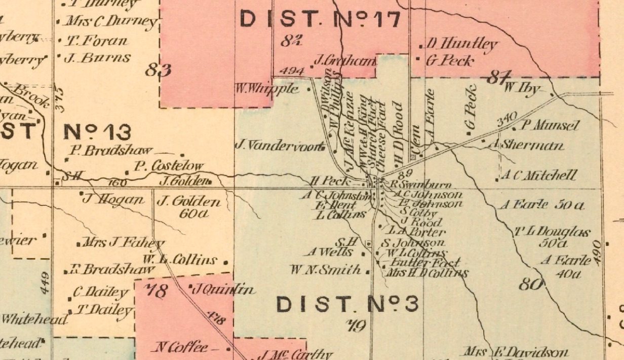
Quaker Settlement and Earlville – Detail From Map of Chateaugay, NY /D.G. Beers’ Atlas of Franklin County, NY 1876


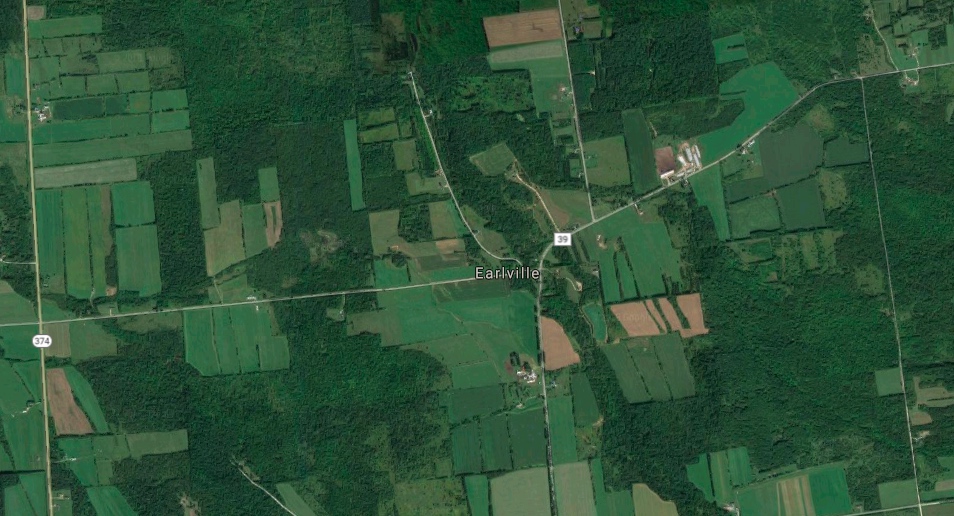
Google Maps Screenshot of Earlville and Quaker Settlement 09/10/2018


It has been far too long between since I put anything up here.  I got overwhelmed by all the research required to do the next few posts about the great aunts, uncles,  and grandparents.  So, while I do a deep dive into aunt Mayme’s probate records, here’s a brief observation.

If you waded through my post about the data from the US census, then you know that I love digging into obscure data to see what it can say about people’s lives and stories.  (You did read it, right?  Here’s a link if your eyes glazed over the first time.)  And if there’s one thing that I love more than annual crop yield statistics, it’s maps.  My God do I love maps.  Old maps.  New maps.  Google Earth, Middle Earth, the AAA TripTik from my 1984 drive from Florida to New Hampshire.  Maps are it, man.

As I spent time poring over the map of Chateaugay from 1876, I was struck by all the houses in Earlville  (or Slab City as we locals call it).  Its a spot on a map with a handful  houses now but,  my dad talked about how the little hamlet (that’s what Wikipedia calls it) at the intersection of the McCormick Road and the Earlville Road had once been it’s own community.  But holy cow – the map below shows more than 20 residences, (most packed tightly together), a starch factory, a cheese factory, a butter factory, and a school. It was a hopping place!

Since families were pretty large back then, I would guess that the population  of Earlville must have approached 100.   With all the people, and three businesses right there,  this neighborhood must have it’s own sense of place. It was a little village tucked into the Northeast corner of town.

A few more observations

  • The old church on the Earlville Road doesn’t appear on the map.   It’s still there today.  It must have been built after 1876.

  • I don’t see any mention of the Gibson family.  Orville Gibson the founder of Gibson Guitars was born in Earlville in the 1850’s.

  • In 1876, the Graham road extended North all the way up to the Shee Wood’s road.   Now it’s a dead end.

There are lots of people who know a lot more about the history of Earlville than I do.  I just thought I’d make a few observations based on what this jaw-droppingly detailed old map shows.

As the screen shot from Google maps shows, many of those houses are gone.   It’s a pleasant drive in the country, but you’d never be able to tell that there was a village here with its own businesses,  school and church.

If this sounds like I’m bemoaning the decline of Chateaugay and Earlville, that’s not my intent.  I’m more interested in remembering and celebrating our history.   It’s just a reminder that our history is all around us – some places grow,  and some shrink. Our collective memory is short.  A lot gets lost in a generation.  Sometimes it takes a quick look at a moldy old map to help us remember.

Rank Speculation and Wild Guesses


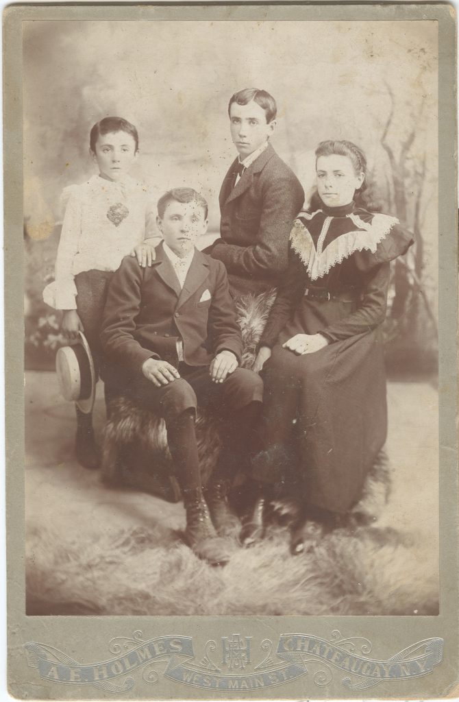
This is one of a few pictures that I have with infuriatingly little information to go along with it.  “Bradshaws” is written on the back in pencil.  No date.  No first names.

There are four people in this posed photograph, taken at the studio of A.E. Holmes, in Chateaugay, NY.  Three boys and a girl.  The boy on the left is wearing a lacy shirt and is holding a straw hat. The others are older, the boys wearing suits, and the girl wearing a dress with a lace collar.  At first, the dress clothes,  the stiff poses and unsmiling expressions make the older three appear to be almost young adults.  On closer inspection they appear to be much younger – probably in their early teens at the oldest.

My dad looked at this picture a number of years ago, and was reasonably certain that this photo depicts his father and some siblings.

So here’s my guess:

Left to right:  Matthew Bradshaw (1889-1996),   Richard Bradshaw (1882-1957), Patrick Bradshaw (1881-1959), Agnes Bradshaw (Boss) (1884-1966).

Here’s my reasoning.

  • These four were the youngest of Patrick and Johanna Bradshaw’s children.
  •  The 1900 federal census shows them as the only children living with Patrick and Johanna.
  • The picture was taken by A.E. Holmes, who was in business in Chateaugay, NY from 1886 until 1899.
  • The youngest boy (who appears to be none too thrilled about his attire) is about 7 – so if that’s Matt then this was taken about 1896.  In that case Richard would be about 14,  Pat 15 and Agnes 12.
  • Based on pictures I have seen from a 1938 family reunion, the three boys look like Matt, Richard and Pat.  I don’t have a picture of Agnes,  but she was the youngest daughter.

I could be wrong about who’s who, and it’s even possible that they’re not Patrick and Johanna Bradshaw’s children.  Patrick’s brother Richard lived nearby also, and had plenty of kids of his own. In any case, I’m confident that they’re family.

I have a couple of requests for the blog’s dedicated readers:

1)  If there are any Bradshaw cousins out there who recognize an ancestor, let me know.

2) If anyone can help identify the year more closely (through clothing, the logo at the bottom or some other feature), I would be very grateful.

Thanks in advance.

The Bradshaw Farm in 1870 – OR – Where Have All The Sheep Gone?

One Horse
One Milch Cow (yes that’s the correct spelling)
Eleven Sheep
Three Pigs

That’s it. That’s all the livestock the Bradshaws of Chateaugay, NY owned in 1870.

The 1870 Federal census includes a “Non-Population Schedule” that describes the property, crops and animal products sold by farmers. It’s a fascinating read… Well actually it’s fascinating if you are an engineer and a bit of a nerd, who likes to stare at spreadsheets full of data (guilty). But before you give up on this post and go back to Facebook or Twitter, or Netflix…

Almost everything about these people is a mystery. All that we have are a few stories, a couple of photographs, and some headstones at Saint Patrick’s Cemetery in Chateaugay, NY. Any concrete piece of data, even mundane enumerations of livestock and crop production is worth wringing for any conclusion we can draw. We don’t know how my great-grandparents met, or whether my great-grandmother Johanna retained an Irish brogue. But we do know that in 1870, they had 50 acres of land, 1 horse, 1 milk cow, 11 sheep, and 3 pigs. They produced 40 bushels of wheat, 75 bushels of oats, 20 pounds of wool, 100 bushels of potatoes, 300 pounds of butter, and 6 tons of hay.

So what does that mean?

First of all they were probably living a fairly meagre existence, even by the standards of the day, if they only had 1 horse, and 1 milk cow. Also, their potato crop was a mere 100 bushels. By comparison, next-door neighbors, and perennial friends of the Bradshaws, the Dwyer family had 3 horses and 9 cows and produced 500 bushels of potatoes. Maybe that was enough for a small family. At the time there were only four adults and 1 small child living on the farm. But still, it sure seems like they were one horse and one cow away from disaster.

Unlike their 20th century descendants, they weren’t dairy farmers. Based on the entries for other farms in the area,there was probably no such thing as a dairy farm, i.e. a farm that made its income solely on what came out of a cow’s udder. Granted, some people sold a lot of butter, but they also sold oats, wheat, corn, and potatoes (lots of potatoes – James Dwyer produced 500 bushels that year).

Wool production seemed common in the 19th century. In the second half of the twentieth century, when I lived there, sheep were a novelty in Chateaugay, and I suspect most of Franklin County. I came across a set of sheep shears when I was a kid, and had no idea what they were for, until my dad told me. I’m curious about when that changed.

So that’s all I’ve got for now. A few meagre observations on some dry facts, but it seems like that’s how it works. You dredge up some facts here, and some third hand family stories there, and hope that a story emerges.

So what I missing? Are there any other revelations or observations that I failed to notice?

As always, comments are most welcome.

Maps and Legends

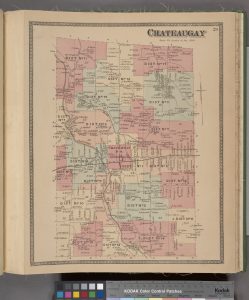
I came across this Historical Map of Chateaugay, NY from an 1876 Atlas of Franklin County, NY It’s got a lot of incredible information in it, largely because it shows the names of businesses and property owners.  In District 13 at the top of the page, you can see the name “P. Bradshaw” right underneath the 13.  There’s a fair amount to unpack here.

First – how cool is it that our farm was in District 13?  Sounds sort of post-apocalyptic.

Second – This map was published in 1876,  so it proves that we were living on the family farm as early as 1876.   Also there are two dots associated with P. Bradshaw,  one near the schoolhouse (SH)  on the corner, and one farther East. The dots appear to be buildings or dwellings.  The dot near the schoolhouse is definitely the main farm. The dot on the right (East) is right where “The Other Place”  was.  The building(s) are north of the brook, which puts them right about where dad showed me a low spot in on of the pastures that he thought was a cellar hole.

So – I guess it’s time to rent some ground-penetrating radar equipment and look for the old homestead.

Third – South of “P. Bradshaw” but still in District 13 is “R. Bradshaw”.  That would have been Richard Bradshaw,  Pat’s brother.    There is an anecdote that Pat and Richard’s families would get together every Sunday, and Pat and Richard would go up the hay loft in the barn and polish off an imperial quart of Canadian Whiskey.   I can still hear Uncle John telling me that one.

Anyways, this map has enough info for lots more posts.

Stay tuned.

1876 Map Of Chateaugay NY (Click to Enlarge)