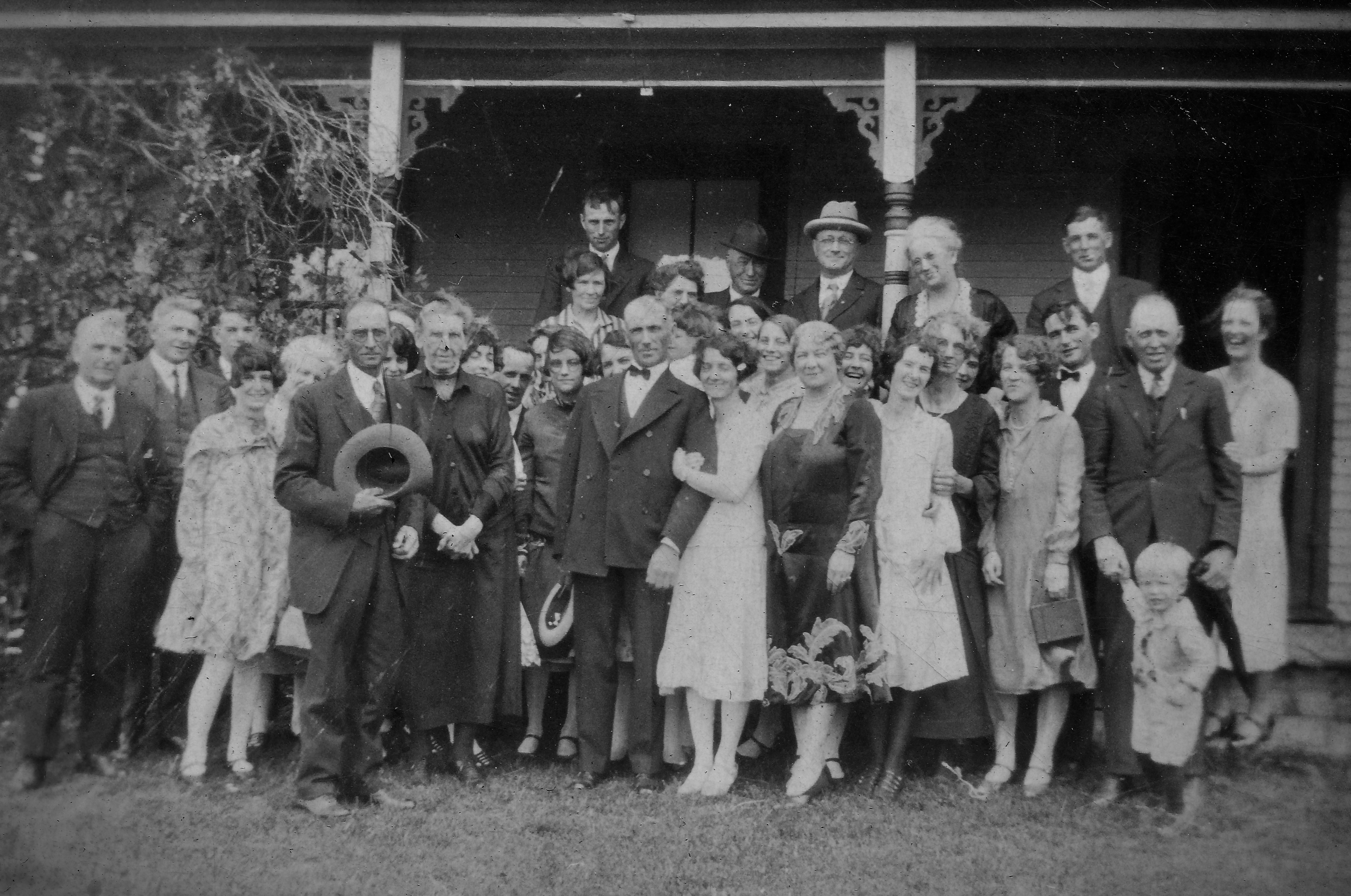
Pat and Henrietta Bradshaw’s Wedding Day – September 1st, 1926.


Pat and Henrietta Bradshaw’s Wedding Day 1926 (Click to Enlarge)

Here’s a picture from my Grandparents’ wedding day in 1926.  My Grandfather, Patrick Bradshaw married my Grandmother, Henrietta Cassidy on Wednesday, September 1st, at (yikes) 7:00 in the morning. Grandpa must have gotten someone else to milk the cows that day.

This photo is the first photo on the first page of a very old photo album that has found its way into my possession.   I assume that Grandma put it together.

Written above the photo are the words “Guests at the home of Mrs. C. Cassidy.  Can you spot the bride and Groom?”

Here’s a link to their wedding announcement in the Chateaugay Record

Patrick is 45 here and Henrietta 31. It was Grandpa’s second marriage.  His first wife, Rosetta  had passed away in 1922, leaving him with two young sons (Uncle John and Uncle Gerald),  they would have been around 5 or 6.

Most of the people in this photo will remain anonymous forever,   but I do recognize a few.  Will Dwyer and Clare Cassidy (soon to be Dwyer) are there.  They were best man and maid of honor.  I see Aunt Leona Cassidy (McCormick) laughing.  I’m reasonably sure that the white haired lady at the back is Clarinda Patenaude Cassidy – Henrietta’s mother.

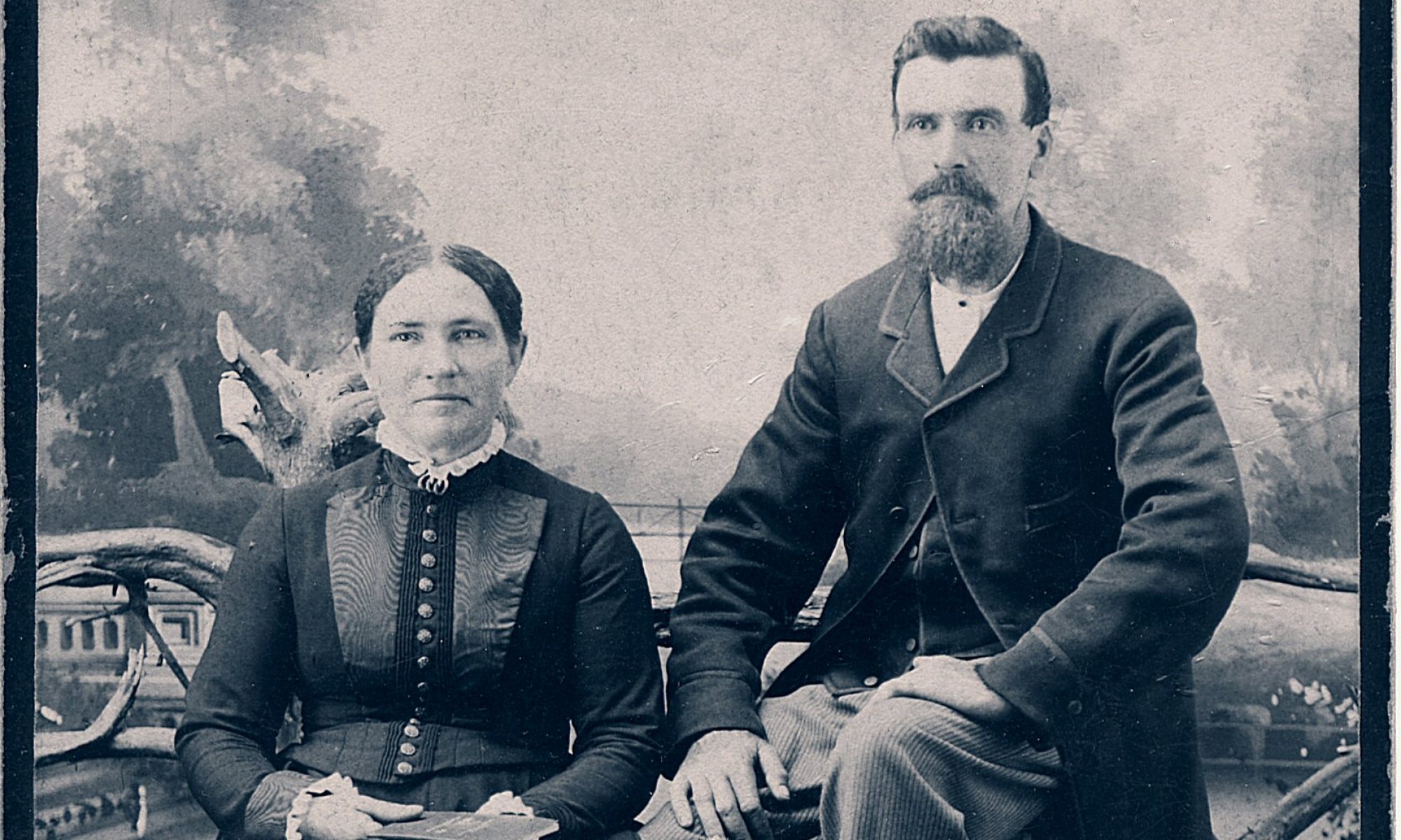
I’m very curious about the man standing next to Grandpa.  He seems to resemble Pat,.  He seems older , so I first thought that he might be Pat’s father (also named Pat – when we find a name we like, we keep using it).  He certainly seems to resemble the man in this picture. But Great-Grandpa Bradshaw would have been in his early eighties, and this fellow seems younger than that.   I’m wondering if it’s Grandpa’s brother Billy (William).

The people on the right are laughing, and seem to be having a good time.   Even Great-grandma Cassidy (who by most accounts was not a lot of yuks).   The people on the left don’t seem to be having as much fun.   A lot of the folks on the right are Cassidys.  It would seem logical (although I have no idea) that those on the right are Bradshaws.

Grandma and Grandpa seem to underscore this division between the laughing, boisterous guests on the right, and the grim pair directly to the left.  Grandma is smiling, genuinely happy.   I’m not sure what to make of Grandpa’s expression and stance.

So – there’s lots more to write about Pat and Henrietta and their life together.  I just thought some of the readers of this blog   –   all 15 of you 😉   – would be interested to see something about Grandpa and Grandma, since I’ve spent most of the words in this blog talking about Grandpa’s siblings.  I have certainly  spent a lot of time staring at this photo, hoping for some revelation or insight about these people.

So PLEASE DO let me know if you recognize anyone in this photo.

As always, comments of any kind are most welcome.

Thanks again for reading.
Earlville

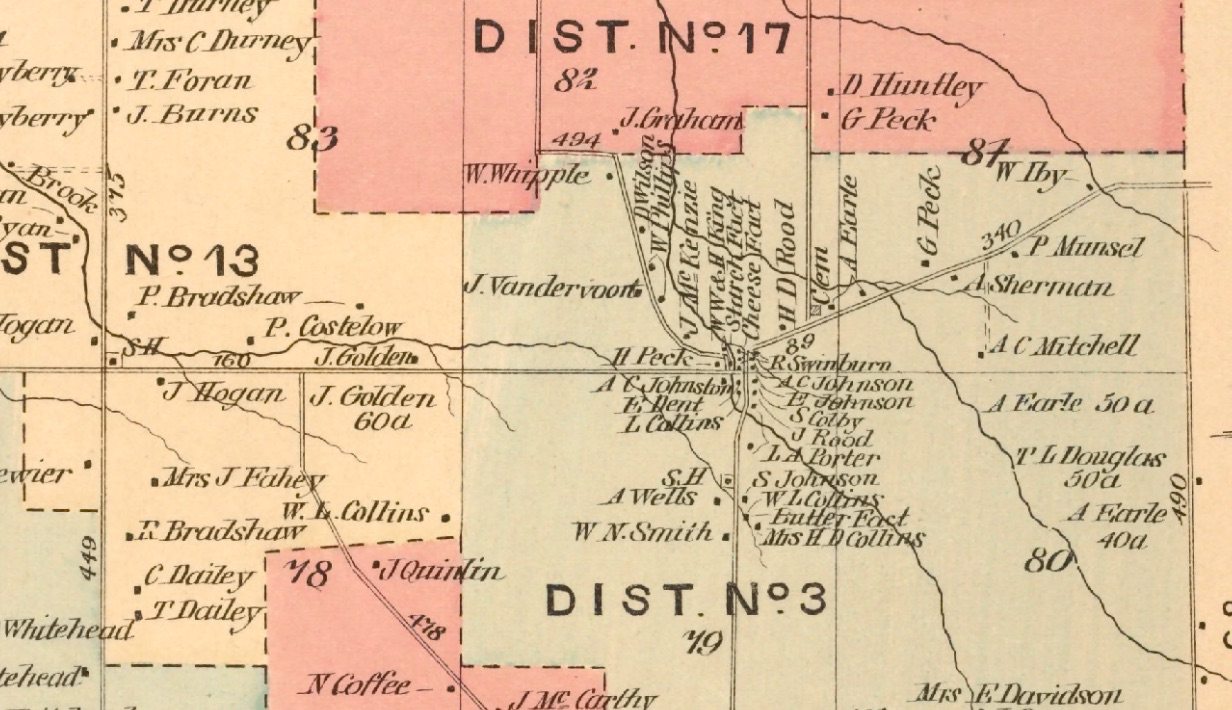
Quaker Settlement and Earlville – Detail From Map of Chateaugay, NY /D.G. Beers’ Atlas of Franklin County, NY 1876


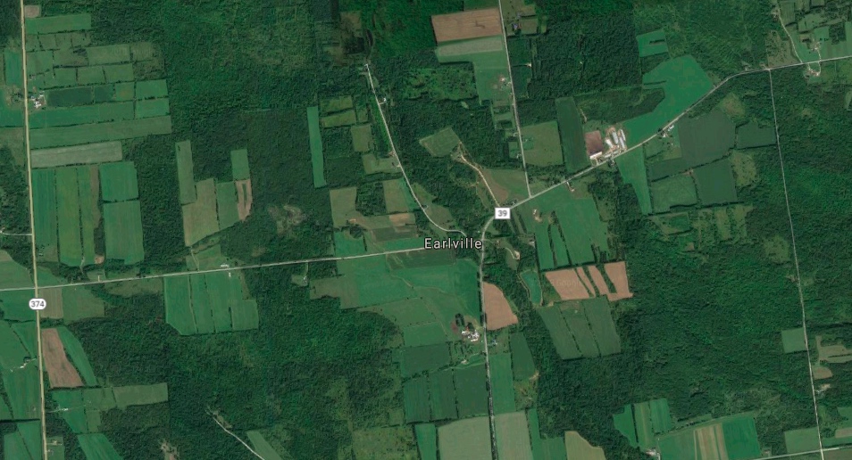
Google Maps Screenshot of Earlville and Quaker Settlement 09/10/2018


It has been far too long between since I put anything up here.  I got overwhelmed by all the research required to do the next few posts about the great aunts, uncles,  and grandparents.  So, while I do a deep dive into aunt Mayme’s probate records, here’s a brief observation.

If you waded through my post about the data from the US census, then you know that I love digging into obscure data to see what it can say about people’s lives and stories.  (You did read it, right?  Here’s a link if your eyes glazed over the first time.)  And if there’s one thing that I love more than annual crop yield statistics, it’s maps.  My God do I love maps.  Old maps.  New maps.  Google Earth, Middle Earth, the AAA TripTik from my 1984 drive from Florida to New Hampshire.  Maps are it, man.

As I spent time poring over the map of Chateaugay from 1876, I was struck by all the houses in Earlville  (or Slab City as we locals call it).  Its a spot on a map with a handful  houses now but,  my dad talked about how the little hamlet (that’s what Wikipedia calls it) at the intersection of the McCormick Road and the Earlville Road had once been it’s own community.  But holy cow – the map below shows more than 20 residences, (most packed tightly together), a starch factory, a cheese factory, a butter factory, and a school. It was a hopping place!

Since families were pretty large back then, I would guess that the population  of Earlville must have approached 100.   With all the people, and three businesses right there,  this neighborhood must have it’s own sense of place. It was a little village tucked into the Northeast corner of town.

A few more observations

  • The old church on the Earlville Road doesn’t appear on the map.   It’s still there today.  It must have been built after 1876.

  • I don’t see any mention of the Gibson family.  Orville Gibson the founder of Gibson Guitars was born in Earlville in the 1850’s.

  • In 1876, the Graham road extended North all the way up to the Shee Wood’s road.   Now it’s a dead end.

There are lots of people who know a lot more about the history of Earlville than I do.  I just thought I’d make a few observations based on what this jaw-droppingly detailed old map shows.

As the screen shot from Google maps shows, many of those houses are gone.   It’s a pleasant drive in the country, but you’d never be able to tell that there was a village here with its own businesses,  school and church.

If this sounds like I’m bemoaning the decline of Chateaugay and Earlville, that’s not my intent.  I’m more interested in remembering and celebrating our history.   It’s just a reminder that our history is all around us – some places grow,  and some shrink. Our collective memory is short.  A lot gets lost in a generation.  Sometimes it takes a quick look at a moldy old map to help us remember.